Technology has captured the world and every professional industry by storm, and artificial intelligence is close behind. In a 2023 study by Goldman Sachs, researchers determined that “generative AI could raise global GDP by 7%” due to the rapid and immediate efficiency boost enabled by automation. General sentiment regarding AI is that automation will replace many jobs—but fear not—researchers also found that “most jobs and industries are only partially exposed to AI and [therefore] more likely to be complemented rather than substituted by AI.”
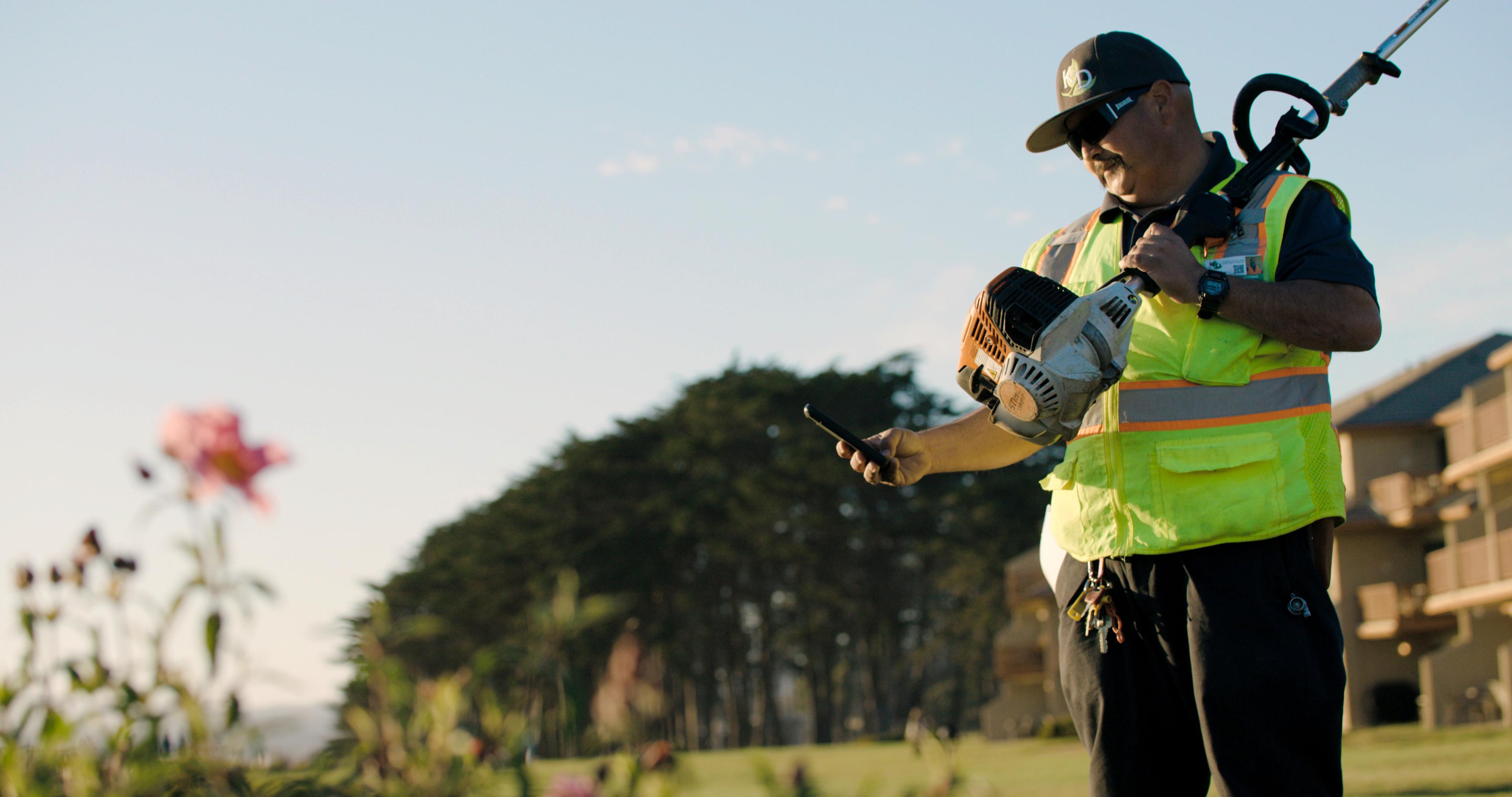
You’re likely already familiar with how software eliminates repetitive tasks, reduces overhead costs, and boosts efficiency, so imagine how much more you can benefit by directly harnessing the power of artificial intelligence as you work.
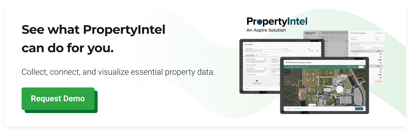
Introducing ProMaps by PropertyIntel: the first true use of automated measuring in the landscape industry that puts the power of AI in the palm of your hands.
What are PropertyIntel ProMaps?
ProMaps is the newest PropertyIntel feature that brings artificial intelligence right into your measuring interface. It provides automatic property feature recognition and slope visualization, further reducing the number of site visits needed before starting a job.
After starting a standard self-measuring project and enabling ProMaps, you are just a few clicks away from creating a nearly complete sitemap:
Define the property boundary.
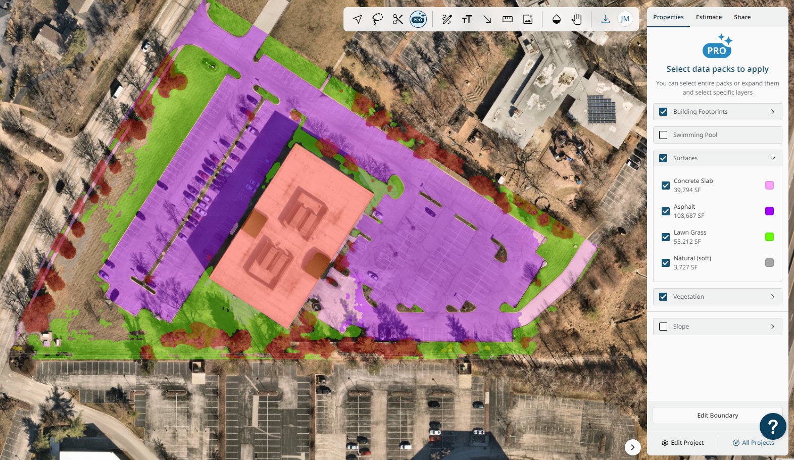
Select the property data you want to view, choosing from:
Building footprints
Swimming pools
Natural (soft) surfaces
Concrete
Lawn grass
Asphalt
Vegetation by height
Slope visualization
Click to convert any data layer into a PropertyIntel Item
And you’re done! Once you have converted the data layers into PropertyIntel Items, you can fine-tune the shapes to your liking, giving you the power to interact directly with the AI data generated in seconds.
How contractors can utilize the power of ProMaps artificial intelligence in their business
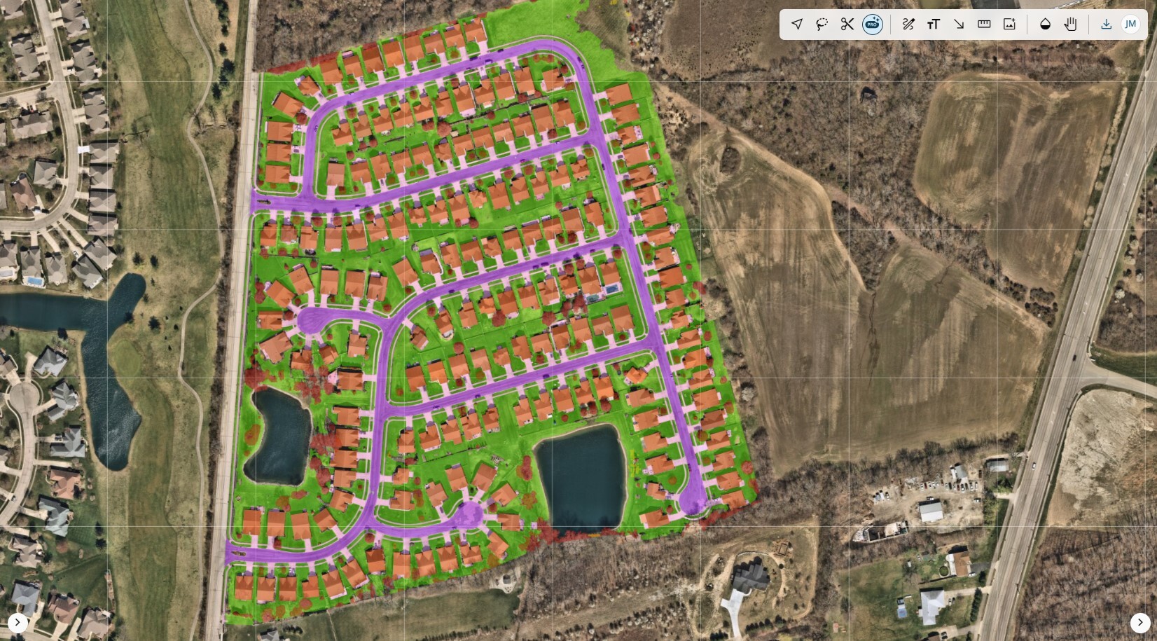
Artificial intelligence is powered by computer models fed data through machine learning programs. In landscape, snow, and ice management, models have been trained to identify property features on the aerial images captured by low-flying airplanes to help you generate takeoffs in seconds.
PropertyIntel’s ProMaps gives you access to the data generated by these AI models, puts the power into your hands, and allows you to interact with it directly. Estimators and account managers spend much time managing customer relationships, contracts, and the data that builds their estimates. Now, they can save hours preparing each property in a few simple steps.
For example, an estimator may spend a full eight-hour day hand-measuring a large commercial property—a vast improvement from error-prone wheel measurements typically employed ten to fifteen years ago. But with ProMaps, they can generate these measurements in seconds, quickly modify the shapes to fit the needs of the proposed work, and automatically get time and material estimates. What has historically been a day-long process can now be accomplished in minutes.
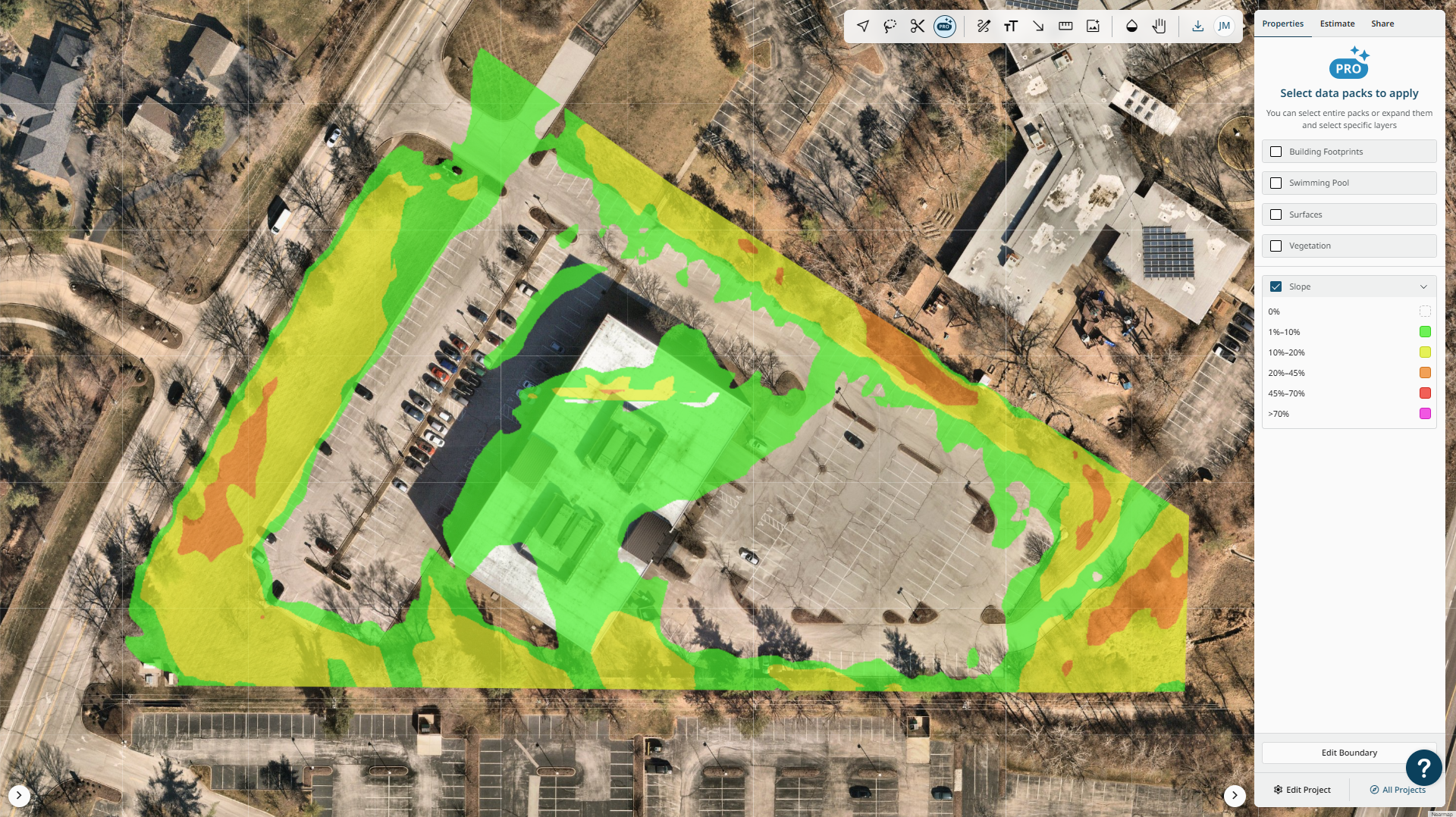
In addition to helping you instantly generate site measurements and boost your efficiency, ProMaps can also be used to assist in job planning. The slope visualization enables you to determine the grade of the ground across the property. Steep areas will show up in red, which helps you decide whether or not it is safe to operate a mower on that part of the property.
Another application of the slope visualization tool, handy for snow management professionals, is using it to understand how a parking lot will drain after a snow and ice event. This vital information is not immediately recognizable in an aerial image without slope visualization, which can vastly change your estimate and job plan based on the equipment that is safe to use or the site conditions.
How contractors benefit from ProMaps
ProMaps, now available for general availability, was thoroughly tested in a closed beta of selected PropertyIntel users for multiple months before release. While they found concrete and asphalt recognition to be the most accurate, PropertyIntel’s advanced measuring tools—like the Merge Shapes tool—made it extremely easy to clean up the slightly less precise turf and vegetation measurements. General sentiment regarding ProMaps is that it is easy to use, saves significant time, and that the slope visualization feature eliminates the need for site visits.
One beta user who transferred to PropertyIntel from another measuring and estimating solution that claims AI-supported takeoffs specifically mentioned that ProMaps is “the future of mapping” and “[PropertyIntel] is the front runner.” He continued sharing, “ProMaps is the first evidence I’ve seen in this market of something resembling AI.”
Christian Frist of Capstone Landscape Management echoes this opinion, saying ProMaps “significantly streamlines the quote creation process [with] its intuitive interface and powerful AI capabilities.” He says ProMaps “integrates seamlessly into existing workflows, saving time and enhancing productivity efficiency.”
Will you be the next professional to join them and increase your business efficiency?
How to get started with PropertyIntel’s ProMaps
Automation is here to stay, and the landscape industry is not excluded from the rapid, exciting improvements coming to technology. The sooner you begin adopting automated technology into your business, the sooner you can reap the benefits. Opportunities to boost productivity, gain new efficiencies, increase your bid rate, close more jobs, and reach new business profitability are just a few clicks away.
Existing PropertyIntel users on the Advanced and Enterprise tiers already have ProMaps turned on in their accounts. Current PropertyIntel customers on the Essential tier can contact us to enable ProMaps.
Contractors interested in experiencing the power of PropertyIntel and ProMaps can create a free 14-day trial of PropertyIntel.